Search Content
Displaying results 201 - 220 of 5027
Interactive Map Gallery
The District’s new map gallery contains dynamic, interactive maps created by District staff. This gallery contains general purpose and District-specific maps. VIEW MAP GALLERY »
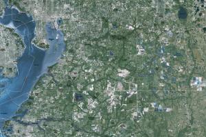
Aerial Photography
The District provides an extensive collection of digital aerial photos (DOQQ: Digital Orthophoto Quarter Quadrangle) …
Your Questions Answered
July 2020
Every year, millions of people visit public conservation lands purchased by the Southwest Florida Water Management District (District) and its partners to protect Florida’s water resources. Ellen Morgan Morrison, the District’s Operations and Land Management Assistant Bureau Chief explains more about District owned and managed lands and how the public can enjoy these properties.
Q: Why does…
Highlights
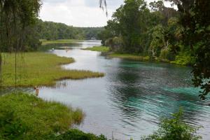
- Home to the fourth largest spring in the state of Florida, Rainbow Springs
- Discharges an average of 493 million gallons of water per day into the Withlacoochee River
- Designated an Outstanding Florida Water and an Aquatic Preserve
- Located in Marion and Citrus counties
- 73-square-mile watershed
Highlights
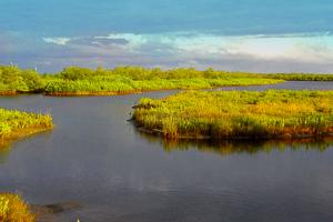
- Charlotte Harbor is Florida's second largest open water estuary at 270 square miles
- Generally considered one of the most productive estuarine ecosystems in southwest Florida
- Designated an "Estuary of National Significance" in 1995
- Includes Charlotte, Lee, and a portion of Sarasota County
- 4,400-square-mile watershed
- Alteration and…

To help achieve its mission, the District promotes behaviors that conserve and protect water resources. Social research can provide information that helps staff design programs that more effectively lead to sustainable behaviors.Not only can social research be used for designing more effective programs, but it can also be used for evaluating those programs. A survey conducted before an educational campaign, for instance, can set a benchmark for what people know, believe and…
Highlights
- Designated an “Estuary of National Significance” in 1990
- Florida’s largest open-water estuary at 373 square miles
- Over 2.7 million residents in the watershed
- Includes portions of Hillsborough, Manatee and Pinellas counties
- 2,200-square-mile watershed
- Update nutrient reduction goals for each bay segment using a revised seagrass-nutrient management paradigm…
Highlights
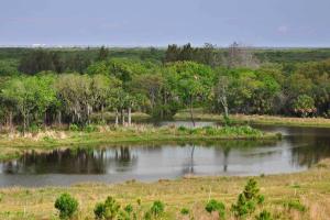
- Homosassa Springs is the headwaters of the Homosassa River and is known as the Homosassa Springs State Wildlife Park
- The park serves as a rehabilitation center and refuge for orphaned or injured manatees.
- Located in Citrus County
- 270-square-mile springshed
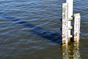
Daily Rainfall UpdateThe rainfall data below provide a summary of daily and month-to-date rainfall totals at 125 locations in the District. The Rainfall Data Collection Sites map shows the locations of the measurement stations and the Daily Rainfall Data chart shows rainfall accumulations in inches. (Click any image to view full size.) …
Your Questions AnsweredMarch 2019Q: What are stormwater ponds and why do we need them?A: A stormwater pond is designed to collect and manage runoff from rainwater. When rainwater lands on rooftops, parking lots, streets, driveways and other hard surfaces, the rainfall that doesn’t soak into the ground (stormwater runoff) flows into your neighborhood stormwater pond through grates, pipes, shallow swales or ditches.…
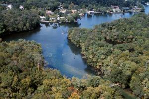
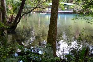
With more than 70 springs, Crystal River/Kings Bay is the largest natural winter refuge for manatees on the Florida Gulf Coast. About the SpringsCrystal River/Kings Bay is a first-magnitude spring system that originates in Citrus County. Kings Bay is a 600-acre bay at the headwaters of the Crystal River, which is a…
Highlights
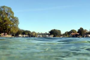
- Lake Tarpon is the largest freshwater lake in the Tampa Bay area
- 2,534 acres of surface area
- Designated an Outstanding Florida Water and a Fish Management Area
- Located in Pinellas County
- 52-square-mile watershed
- Decline in water quality due to highly urbanized watershed inputs
- Imbalanced fish communities
- Increased…
August 2024Q: What are stormwater ponds and why do we need them?A: A stormwater pond is designed to collect and manage runoff from rainwater. When rainwater lands on rooftops, parking lots, streets, driveways and other hard surfaces, the rainfall that doesn’t soak into the ground (stormwater runoff) flows into your neighborhood stormwater pond through grates, pipes, shallow swales or ditches. Stormwater ponds are required for…
Highlights
- Tidally influenced Kings Bay is the headwater of Crystal River
- Hydrologically unique springs system comprised of more than 30 springs
- Designated an Outstanding Florida Water
- Located in Citrus County
- 364-square-mile watershed
- Kings Bay forms the largest, natural warm-water refuge for the Florida Manatee in the United States.
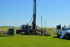
The ROMP Objectives
- Provide information about the groundwater systems within the District.
- Monitor saltwater intrusion along the coast.
- Identify areas of poor groundwater quality.
- Install wells for water level and water quality monitoring.
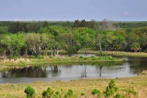
Homosassa Springs has been a tourist attraction since the early 1900s and is now located within a state park that features a fishbowl observatory and manatee rehabilitation. About the SpringsThe Homosassa River is a first-magnitude spring system originating in western Citrus County. Homosassa Springs is at the headwaters of this short, slow moving tidal river, which flows 8 miles from the headsprings to where it meets the Gulf of America.Many springs make up the…
WUPs require submittal of an application form that is dependent upon the annual average quantities requested and one or more supplemental forms. Choose the appropriate application form and include the appropriate supplemental form(s).Application FormsTo renew or modify or apply for a new water use permit (Form LEG-R.100.00; Rule 40D-2.101(1) – May 19, 2014) (Form LEG-R.035.02; Rule 40D-2.331(2)(b) – May 19, 2014)To transfer a water use permit (Form LEG-R…
The Southwest Florida Water Management District (District), in cooperation with Hillsborough County, completed the largest habitat restoration project ever done in the history of Tampa Bay. Project BackgroundIn 2009, the District’s Surface Water Improvement and Management (SWIM) program began working to design and construct the largest coastal restoration project ever performed for Tampa Bay. This project was a cooperative effort between SWIM and the Hillsborough County…
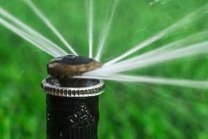
The Southwest Florida Water Management District’s (District) Governing Board declared April Water Conservation Month at its March 25 meeting. April is historically one of the driest months of the year and typically marks the peak demand season for public water suppliers. With these 10 simple tips, you can lower your monthly water bill and do your part to save hundreds of gallons of water: INDOOR
- Only run your washing machine and…

April is Water Conservation Month across the state because this month is traditionally one of the driest of the year and typically marks the peak demand season for public water suppliers.
It’s also a good time to remember there are a number of easy ways to save water and money.
Some simple habits can make a big difference by saving thousands of gallons per year. Other changes may save only a few drops at a time, but when multiplied by almost five million residents…
Rainfall summaries are available as spreadsheets for downloading to your computer. Summaries are tabulated by specific geographic areas, such as county or drainage basin boundaries, for that portion of the geographic area within SWFWMD boundaries. Each page within a spreadsheet shows period-of-record rainfall totals in inches (based on area-weighted average values) for 1915 through the previous calendar year by month, wet season, dry season, calendar year, or water year.…