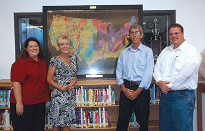
 Left to right, Lakeland Senior High School Assistant Principal Ann Everett, Principal Tracy Collins, Florida Department of Environmental Protection Environmental Specialist Charles Cook, and District Senior Geologist/Engineer Joe Oros display a “Tapestry of Time and Terrain” geologic map of the United States that Cook and Oros presented to the school as part of the Maps in Schools project.
Maps in Schools is a program of the Southeastern Geological Society, the Florida Geologic Survey, the Gulf Coast Association of Geological Societies, and the U.S. Geological Survey. The program provides schools across the country with geological science educational materials and detailed geologic maps that combine information on time and terrain. The District and its partners plan to present maps to other Polk County schools in the future. The map was presented in honor of the late Tom Jackson, an alumnus of Lakeland Senior High School and past president of the Southeastern Geological Society.