Overview
Minimum flows are limits established by the District’s Governing Board for surface watercourses to prevent significant harm to the water resources or ecology that may result from water withdrawals. Florida Statutes require the development of a recovery strategy when existing flows fall below the applicable minimum flow.
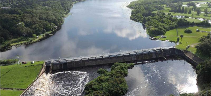
The District has established minimum flows for the Lower Hillsborough River to help protect the river’s ecological health and support a sustainable water supply.
In 2007, revised minimum flows were adopted and a recovery strategy was developed for the Lower Hillsborough River. A joint funding agreement with the City of Tampa to implement recovery projects was also incorporated into the rule.
The recovery strategy requires periodic evaluation of implementation and effectiveness. The first five-year evaluation was published in 2015, and the second was provided to the District’s Governing Board in May 2020. The third five-year assessment was provided to the Governing Board in January 2026. Both reports can be viewed below.
The District continues to evaluate the recovery strategy to ensure progress toward long-term ecological goals.
Recent Progress
District staff recently completed a five-year assessment to evaluate the effectiveness of the recovery strategy.
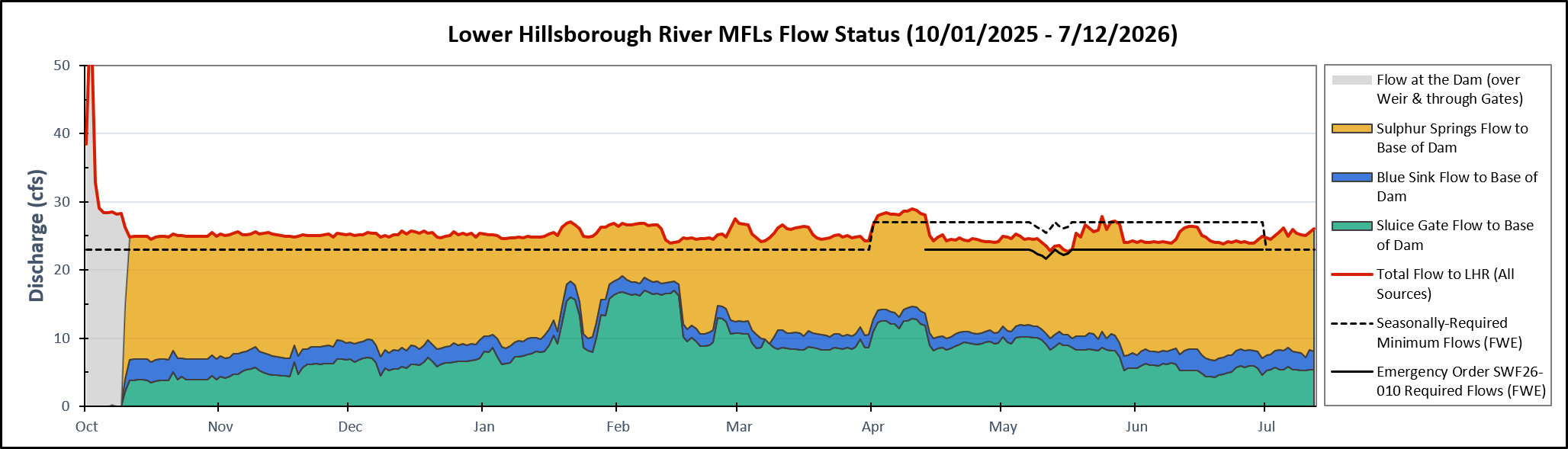
Results indicate that key ecological conditions in the river are being maintained, including the availability of low-salinity habitat downstream of the dam. Ongoing evaluation will continue to ensure that recovery efforts remain effective and sustainable.
Ongoing Efforts
The District continues to:
- Monitor river conditions, including flow and water quality
- Evaluate the effectiveness of recovery actions
- Adapt management strategies as needed to support long-term river health
Minimum Flows Five-Year Reports
Data files that will support the Third Five-Year Assessment are available for download below.
This file contains the consolidated daily average minimum flow implementation data from the USGS, City of Tampa, and the Southwest Florida Water Management District for the Lower Hillsborough River. The period of record for this data is 1/1/1996-12/31/2023.
This file contains the consolidated and standardized water quality data collected by USGS, City of Tampa, Southwest Florida Water Management District, Tampa Bay Water, Hillsborough County Environmental Protection Commission, and the Florida Department of Environmental Protection in the Lower Hillsborough River and Morris Bridge Sink between 1/1/1996 – 12/31/2023.
This file contains the consolidated and standardized Nekton data collected by Tampa Bay Water and the Southwest Florida Water Management District in the Lower Hillsborough River between 1/1/1996 - 12/31/2023.
This file contains the consolidated and standardized zooplankton data collected by Tampa Bay Water, the Southwest Florida Water Management District, Hillsborough County Environmental Protection Commission, and the Florida Department of Environmental Protection in the Lower Hillsborough River between 1/1/1996 - 12/31/2023
This file contains the consolidated and standardized benthic macroinvertebrate data collected by Tampa Bay Water and the Southwest Florida Water Management District in the Lower Hillsborough River between 1/1/1996 - 12/31/2023.