Search Content
Displaying results 1 - 20 of 2280
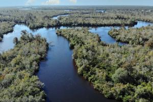
Overview The Southwest Florida Water Management District is currently developing new minimum flow standards for the Upper Peace River. Minimum flows are limits established by the District’s governing board for surface water courses and are intended to prevent significant harm to the water resources or ecology of an area that may be caused by water withdrawals. The Upper Peace River, which is the northernmost section of…
Peace River Challenges and RestorationNatural factors, such as the geology of the region and rainfall, contribute to the amount of water recharging the Upper Floridan aquifer and surface water bodies in the area as do human influences, such as groundwater use. There have also been substantial changes to the Peace River watershed over the past 150-200 years, including the clearing, draining and re-contouring of lands for phosphate mining, agriculture and urban…
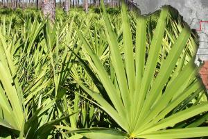
Conservation LandsThe region’s lands and waters are forever linked by Florida’s natural water cycles. Undeveloped land allows for water recharge to the aquifer and water storage during major storm events. Lands surrounding lakes, rivers, wetlands and estuaries also serve as natural buffers to filter out pollution before it reaches the nearest water body. The Southwest Florida Water Management District and other agencies and governments purchase conservation lands to preserve…

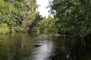
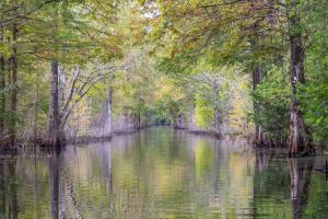
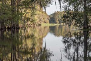
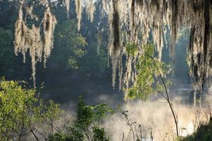
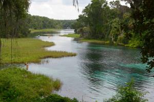
It’s morning on the Peace River. Life comes to the river, and the river comes to life...
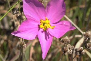
One may hear the cry of a limpkin or see little blue herons wade with outstretched wings.
Slider turtles balance on a tree snag, while alligators creep nearby.
It’s a scene repeated daily.
The river is of importance to more than wildlife too.
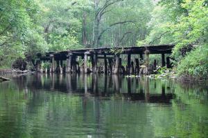
People have used the river for thousands of years. The Native Americans…
These Lake Hancock projects have played a critical role in the District’s recovery plan for the Upper Peace River. Due to the extreme drought conditions, the Lake Hancock P 11 water control structure is closed to maintain minimum water levels in Lake Hancock. Low oxygen conditions in the lake may result in fish kills. The lake level will increase with sufficient summer rainfall.Lake HancockLake Hancock is one of the largest lakes in Polk County. It…
Florida law requires establishment of minimum flows and levels of water bodies to prevent significant harm associated with water withdrawals.Program overviewFlorida law (Chapter 373.042, Florida Statutes) requires the state water management…
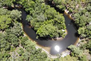
A watershed is an area of land that water flows across as it moves toward a common body of water, such as a stream, river, lake or coast.Watershed BasicsWe all live in a watershed and if you live near a spring, you live in a springshed.Watersheds are defined by the way water flows across the land and are shaped by features and elevations on the surface of the land. …
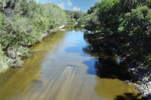
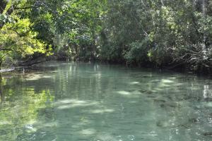
The Peace River gets its fresh water from rainfall. Annual rainfall averages approximately 53 inches, with more than half occurring between June and September. Most of the rainwater reenters the atmosphere through evaporation and plant transpiration. The rest recharges the aquifer or runs off into the Peace River and its tributary streams. The river is primarily a blackwater river. This type of river drains pine flatwoods and cypress swamps and has dark, stained waters…
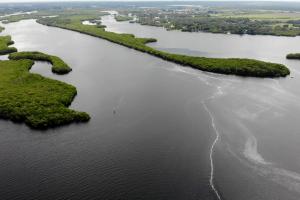
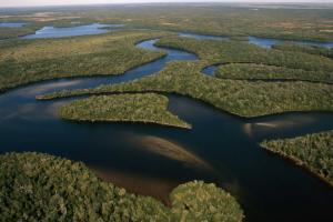
The Peace River begins in northern Polk County at the junction of Saddle Creek and the Peace Creek Drainage Canal northeast of the city of Bartow. From there, it runs approximately 105 miles south to the Charlotte Harbor estuary, where it blends with the outflows of the Caloosahatchee and the Myakka rivers. Its watershed encompasses more than 2,300 square miles and is called the Peace River Valley by locals. A watershed is an area of land that water…
A tributary is a small stream or river that flows into a larger one. The Peace River is fed by many tributaries.Saddle CreekIn the northern portion of the watershed, Upper Saddle Creek originates in the Green Swamp and flows into Lake Hancock, the largest lake in the watershed. Lower Saddle Creek drains out of Lake Hancock before it meets Peace Creek and forms the Peace River northeast of Bartow. Peace CreekPeace Creek originates near Lake Hamilton and passes…
A Water Use Caution Area, or WUCA, is an area where regional action is necessary to address cumulative water withdrawals which are causing or may cause adverse impacts to the water and related natural resources or the public interest. The District Governing Board designates WUCAs and establishes rules that enhance the protection and/or…
Four rivers impressively emerge from the Green Swamp. They are the Hillsborough, Withlacoochee, Ocklawaha and Peace rivers. These rivers provide much of central Florida’s water supply. Check out these stats and visit our other virtual watershed excursions to learn more about these rivers.Hillsborough River
- Total length: 55 miles
- …
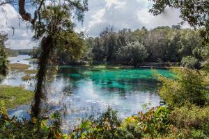
The Rainbow River in Marion County begins at Rainbow Springs in the town of Dunnellon and makes its way 5.7 miles until it merges with the Withlacoochee River. The Withlacoochee River ultimately discharges into the Gulf of America on the border of Citrus and Levy counties.Rainbow Springs has the fourth largest flow of all Florida’s springs and provides fresh water to the Rainbow and Withlacoochee rivers. The…
Protecting the upper reaches of the Hillsborough River, the river's floodplain provides natural storage of floodwaters and acts as a filtration system for runoff. The property also serves as an important link in protecting wildlife habitat in the Hillsborough River greenway corridor. The property's roads and trails meander through pine flatwoods, consisting of both slash and longleaf pine overstory, palmetto/gallberry understory and hydric hammock and floodplain swamp…
The Homosassa River is another spring fed river beginning at Homosassa Springs. This short, slow-moving tidal river flows eight miles from the headsprings to where it meets the Gulf of America in Citrus County.The river is a mixture of fresh water from the headsprings and salt water from the Gulf of America. The tidal influence makes the river home to both freshwater and saltwater fish. Some of the freshwater fish you'll find in the Homosassa River include Bluegill,…
The initiative was designed to better understand the dynamics of the river and watershed, identify how alterations have affected the system, and evaluate alternatives to better manage the water resources. STATUS UPDATE: A peer review of the Withlacoochee River Model was completed in 2020. This peer review concluded that the model results and conclusions are accurate and can be relied upon for resource management and understanding of this complex river…
Join us in the community effort to protect the Weeki Wachee River. The Weeki Wachee River is a great place to experience natural Florida. This river flows 7.4 miles from the headspring to where it meets the Gulf of America at Bayport in Hernando County. It’s a popular spot for kayaking and boating. But increased recreational activities have had negative environmental impacts on the river. Here are some ways you can recreate responsibly and…
The Southwest Florida Water Management District is currently developing new minimum flow standards for the Upper Peace River. Minimum flows are intended to prevent significant harm to the water resources or ecology of an area that may be caused by water withdrawals. The draft minimum flows report for the Upper Peace River,…
River Model Scenarios
Nineteen scenarios have been identified through years of meetings and workshops with external stakeholders, special interest groups and residents. These scenarios are being tested by the model to show how historical alterations have affected the river and watershed. They include:
- Five scenarios in the Green Swamp…
Rainbow Springs is known for its outstanding water clarity and is popular for swimming and paddling. About the SpringsThe Rainbow River is a first-magnitude spring system originating in Marion County. Rainbow Springs is the headwaters of this short, freshwater river flowing nearly 6 miles from the headsprings to where it meets the Withlacoochee River. …