The initiative was designed to better understand the dynamics of the river and watershed, identify how alterations have affected the system, and evaluate alternatives to better manage the water resources.
STATUS UPDATE: A peer review of the Withlacoochee River Model was completed in 2020. This peer review concluded that the model results and conclusions are accurate and can be relied upon for resource management and understanding of this complex river system. For more information or to request a presentation, email the project manager.
Project Overview
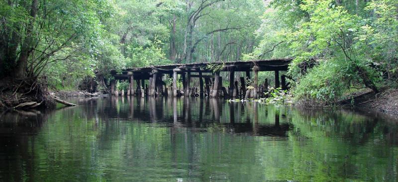
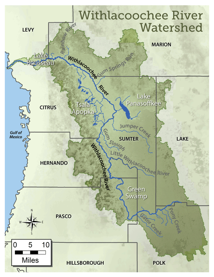
The District is studying the Withlacoochee River (see map) and its surrounding watershed from the Green Swamp to the Gulf of America. The Withlacoochee River watershed includes the area of land that water flows across as it moves to the Withlacoochee River. This watershed contains a variety of natural environments and man-made alterations which affect the behavior of the river. In addition, the river system has experienced extreme high and low conditions in recent decades due to fluctuations in rainfall.
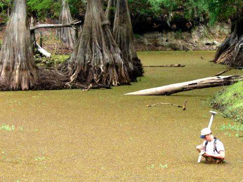
As part of this initiative, staff have performed hydrology and hydraulics studies, field investigations and engineering analyses to evaluate how the river system functions. This included the development of a comprehensive computer model of the entire Withlacoochee River, which has been calibrated using in-depth field surveys and published gauge data. Several scenarios were evaluated with the model to determine the impact of historical alterations and to define how changes in one area might affect other areas of the watershed. The model results have helped define the overall dynamics of the river and watershed which allow staff to better manage the water resources.
View the River Model Scenarios »
Outreach Activities
In 2015, several public meetings were held to present the models results and solicit feedback. Based on input received from the public, additional scenarios were evaluated and projects were implemented to improve the water resources.
Since 2015, District staff have provided monthly email updates to residents and stakeholders, keeping them informed about changes to the Withlacoochee River and its surrounding watershed. These updates include data trends for rainfall, water levels, river flow, structure operations and other important information. Monthly email updates are provided for the following areas of the watershed:
- Withlacoochee River (from the Green Swamp downstream to Dunnellon)
- Tsala Apopka Chain-of-Lakes
- Lake Panasoffkee
- Lake Rousseau and the Lower Withlacoochee River
Sign up for email updates about the Withlacoochee River System »
District staff are also available to provide presentations about the Withlacoochee River Watershed or to meet with residents/organizations to discuss the river system.
Facts About the Withlacoochee River and Watershed
- The Withlacoochee River watershed covers approximately 2,100 square miles in parts of Citrus, Hernando, Lake, Levy, Marion, Pasco, Polk and Sumter counties.
- The Withlacoochee River is approximately 160 miles long and originates in the Green Swamp extending northward through eight counties before eventually discharging into the Gulf of America near Yankeetown, Florida.
- The river is designated an Outstanding Florida Water by the Florida Department of Environmental Protection.
- Approximately 80 percent of the Green Swamp, a designated Area of Critical State Concern because of its ecological and hydrological importance, lies within the headwaters of the watershed.
- Historical alterations due to navigation, logging, mining and ranching have occurred as far back as the 1800s in the Withlacoochee River watershed. In addition to these alterations, the system has experienced extreme high and low conditions in recent decades due to natural fluctuations in rainfall and groundwater levels.