The Northern Planning Region encompasses all of Citrus, Hernando and Sumter counties and portions of Lake, Levy and Marion counties. It is one of the more rural areas of the Southwest Florida Water Management District, with agriculture, rangeland, upland forest and wetlands constituting approximately 75 percent of all land uses. Population centers include Ocala, northern Sumter County and western Hernando County. The region includes extensive tracts of federal, state and District-owned conservation lands used and maintained for timber management, ecological restoration, public recreation and conservation purposes. Limestone mining activities occur primarily in Hernando, Levy and Sumter counties, with significant agricultural activities occurring throughout the region.
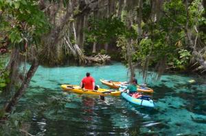
The Withlacoochee River is the dominant surface water feature of the region, which also includes the Chassahowitzka, Crystal, Homosassa, Halls, Rainbow and Weeki Wachee rivers. Lakes include Bonable, Panasoffkee, Rousseau and Tsala Apopka. Several first-magnitude springs are located in the region (the Chassahowitzka, Crystal River, Homosassa, Rainbow and Weeki Wachee Springs groups) along with numerous smaller springs of second-magnitude or less. The Floridan aquifer system, the principal storage and water-conveying aquifer in the Northern Planning Region, is overlain by a relatively thin sequence of sands, silts and clays. As a result, the Upper Floridan aquifer within the region is not under confined conditions as it is throughout much of the remainder of the District.
The Northern Planning Region is unique in comparison to the other planning regions in that demands are not projected to outpace available sources through the planning horizon of 2035. The region is included in the District’s Regional Water Supply Plan (RWSP) in order to be proactive and minimize any issues related to future regional water supply demands and/or source development. Increases in water demands in the region for the 2015–2035 planning period are projected to be met through development of additional available groundwater sources, with conservation efforts and reuse projects being key components in offsetting or reducing the level of development needed for these additional groundwater sources.
Since 2011, the District has been working collaboratively with regional water supply utilities, the St. Johns River and South Florida water management districts (WMDs), the Florida Department of Environmental Protection (FDEP) and the Florida Department of Agriculture and Consumer Services (FDACS) on the Central Florida Water Initiative (CFWI). The CFWI region covers five counties, including southern Lake County as well as Orange, Osceola, Seminole and Polk counties. This is an area where the WMDs have determined, through water supply planning efforts, that groundwater availability is limited. The CFWI mission is to help protect, develop, conserve and restore central Florida’s water resources by collaborating to develop a unified process to address central Florida’s current and long-term water supply needs. A Steering Committee oversees the CFWI process and includes six members representing water utilities, FDEP, FDACS and a Governing Board member from each of the three WMDs. The Steering Committee has guided the development of the first-ever CFWI RWSP, which ensures the protection of water resources and related natural systems and identifies sustainable water supplies through 2035. CFWI efforts will be reflected in the District’s 2015 RWSP update for the Northern Planning Region, and will lead to adoption of new rules and management strategies. Additional information about the CFWI can be found at CFWIwater.com.
