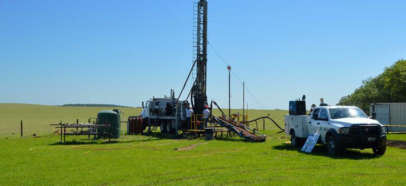
Geohydrologic Data
Geohydrologic data includes aquifer test data, geohydrologic profile data (water level, slug test, and water quality), stratigraphic data, lithologic logs, geophysical logs, and geohydrologic well site reports and summaries. The majority of geohydrologic data are collected through the Regional Observation and Monitor-well Program (ROMP). More information on the ROMP can be found on the Regional Observation and Monitor-well Program (ROMP) webpage.
The Environmental Data Portal (EDP) is the District’s official database of groundwater and surface water levels, flows, water quality, and atmospheric data such as rainfall, wind direction, and temperature. The EDP also provides specific information about data collection sites such as location and well construction details.
Reports
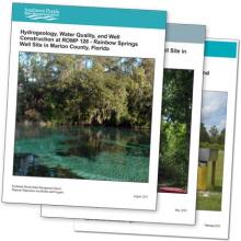
The District issues reports after monitor well construction and aquifer testing. The reports are accessible from 1974 to present. New reports are added as they become available.
- Hydrogeology, Water Quality, and Well Construction at the ROMP 88 – Rock Ridge Well Site in Polk County, Florida
- Well Construction at the Eagle Lake Well Site in Polk County, Florida
- Well Construction at the Lake Aurora Well Site in Polk County, Florida
- Well Construction at the Trout Lake Well Site in Polk County, Florida
Geohydrologic Data Interactive Map »
View an interactive map of all Geohydrologic Data well sites, links to associated well site reports, lithologic core descriptions, geophysical logs, lithostratigraphic units, hydrostratigraphic units, and aquifer test characteristics for select well sites.
Stratigraphic Correlation Charts »
The naming convention used for the hydrogeologic units in the Southwest Florida Water Management District (District) are consistent with aquifer nomenclature guidelines proposed by Laney and Davidson (1986) and the North American Stratigraphic Code (2005). These correlation charts provide a comparison of the current nomenclature used at the District and in previously published reports. The correlation charts can be used to understand the progression of hydrostratigraphic and lithostratigraphic units from previously published District reports and the District’s current understanding of units.
Work Plan and Performance Metrics:
Other Geohydrologic Data Sources
In addition to the District’s geohydrologic data, the following are links to other sources of geohydrologic data.
Florida Geological Survey — Data and Maps »
Florida Geological Survey — List of Publications »
Northwest Florida Water Management District — Pump Test Results »
St. Johns River Water Management District — Groundwater Resource Assessment »
South Florida Water Management District — Hydrogeologic Data »