Search Content
Displaying results 621 - 640 of 2160
Your Questions Answered
June 2020
We're often asked about the water resources in our area and what we do to manage and improve their water quality. Southwest Florida Water Management District Chief Water Quality Scientist Chris Anastasiou explains what water quality really means and the District’s role in managing the region’s water quality.
Q: What is water quality?
A: Water quality is a broad term…
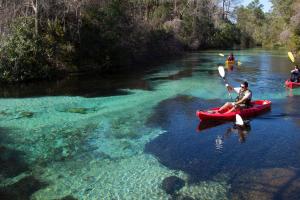
The District uses a variety of tools to protect our springs but it takes a community effort by all of us. There is no single solution to protecting Florida springs. The District uses a variety of tools to help protect them. But it takes the work of all of us to protect these resources. There are various ways you can help when visiting a spring and even at home. How to responsibly enjoy a spring:
- Stay in the vessel when possible.
- If you have to…
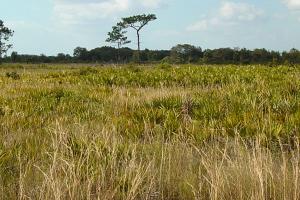
Public water supply facilities, agriculture, wildlife habitat conservation and passive recreation characterize the diversity of the working landscape at the RV Griffin Reserve. The reserve offers vistas of pine flatwoods, freshwater marshes, wet prairies and glimpses of forested wetlands and oak hammocks. Much of the flatwoods have a sparse overstory of pines and resembles Florida dry prairie, one of North America's most imperiled ecosystems. The property is managed by…

The Southwest Florida Water Management District (District) will hold a public workshop Tuesday, June 11, to share information about the proposed minimum flow reevaluations for the Chassahowitzka and Homosassa River Systems. The meeting will take place at the College of Central Florida, Citrus Campus, Citrus Conference Center Building C4, located at 3800 S. Lecanto Highway…
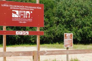
Located in the southwest corner of the Lower Hillsborough Wilderness Preserve, the Jefferson Equestrian Area is surrounded by urban development. The trail roughly parallels Cow House Creek, a tributary of the Hillsborough River, and offers canopied riding for local horse enthusiasts. Interestingly, water in this creek can flow east or west, depending on water levels in the Hillsborough River and the…
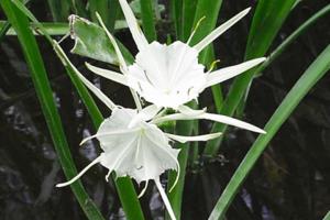
This property was acquired to protect and preserve natural water resources and the water quality of the Withlacoochee River, Gum Slough and associated tributaries. The Withlacoochee River, Gum Slough and Gum Springs Run are located adjacent to the property and were designated Outstanding Florida Waters in 1989. Gum Slough is a four-mile-long spring run that flows into the Withlacoochee River. The water in Gum Slough comes from several springs, which makes it…