Search Content
Displaying results 1881 - 1900 of 4998
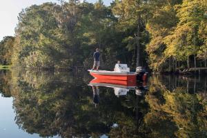
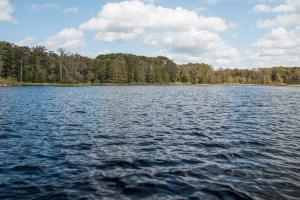
Boating »
Where possible, launch facilities are provided for boaters on District lands.
There are many recreational opportunities available on water bodies throughout the District including boating, canoeing, kayaking and fishing. All visitors taking part in water sports should keep safety first. The Florida Fish and Wildlife Conservation Commission (FWC) regulates…
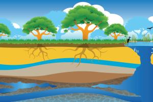
Aquifer »
Aquifers are underground layers of rock and sand that hold water. These layers are made up of loosely packed sediments and layers of calcium-rich limestone and dolomite. In Florida, most of the population depends on the Floridan aquifer for their drinking water. The Floridan aquifer, which is the largest and deepest aquifer in the state, holds groundwater like a sponge. Holes in the rock that make up the aquifer allow the water to move freely through it. Aquifers are…
This Statement of Agency Organization and Operation (“Statement”) is issued and maintained as required by Sections 120.53 and 120.54, Florida Statutes (“F.S.”) and Chapter 28-101, Florida Administrative Code (“F.A.C.”). This Statement is intended to assist the public in understanding how the Southwest Florida Water Management District operates, how it is organized, and how to do business or interact with the District.Introduction: What is the Southwest…
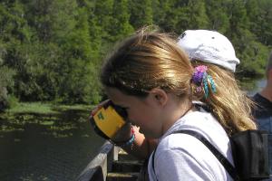
The Splash! school grant program provides up to $3,000* per school to enhance student knowledge of freshwater resources issues. Public and charter school teachers of grades K-12 are eligible to apply. Grant applications for the 2025-2026 school year are now closed.Getting Started Use the links below to learn more about implementing a Splash! school grant. Please note that Splash! grants are only available to educators within the Southwest Florida Water Management…
Florida’s coastal ecosystems are among the most diverse in the world. At the heart of these ecosystems is seagrass—a vital underwater plant that supports marine life, improves water quality, protects shorelines and stores carbon.Since 1988, the Southwest Florida Water Management District (District) has mapped seagrass to help guide decisions that protect and sustain our bays, estuaries and coastal waters. But how exactly is seagrass mapped and why is it important? The…
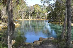
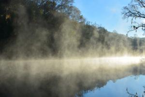
A spring is a place where groundwater discharges from the underlying limestone bedrock to the Earth's surface through a natural opening in the ground. In the Springs Coast Watershed, the Floridan aquifer is close to the land surface, which means that the springs are exposed portions of the aquifer! As windows into the aquifer, springs have long been one of Florida's most valued natural and scenic resources. In 1513, the Spanish explorer Ponce de Leon came to Florida in…
The Southwest Florida Water Management District is in the process of developing the 2025 Regional Water Supply Plan (RWSP). The plan lists projected water demands as well as possible water sources for each region of the District through the year 2045. The draft RWSP is posted on the District webpage. Comments may be submitted virtually thought the webpage.…
The Southwest Florida Water Management District is in the process of developing the 2025 Regional Water Supply Plan (RWSP). The plan lists projected water demands as well as possible water sources for each region of the District through the year 2045. The draft RWSP is posted on the District webpage. Comments may be submitted virtually thought the webpage. At the workshop…
The Southwest Florida Water Management District (District) acquires lands for the conservation and protection of the water and water-related resources, including lakes, rivers, wetlands and estuaries. These conservation lands serve as natural filters improving water quality, storing and retaining flood waters and helping recharge our aquifers. They also are home to many native plants and animals.
The District is required to maintain a balance between public access,…
Please read these important details:
- If requesting Splash! grant funds to support an on-site or virtual field trip, please select a program (not just location) from this list.
- Field trip locations must be one hour or less drive time from your school. Notice the counties listed in parenthesis next to the field trip programs. This indicates that most schools within that county are likely to meet the travel requirement.
- Notice the grade…
Over time, the springs’ water quality and amount of water they discharge have been threatened by both human activities and natural factors. The challenges facing our springs include:
- Increases in nutrients like nitrogen and phosphorus due to development in springsheds, excessive fertilizer use and failing septic tanks. Excess nitrate levels in water can be harmful to aquatic insects, amphibians and fish. If algae have an…
As bureau chief of General Services, Dave Dickens oversees the District’s Document Services, Public Records, Fleet Services and Facilities sections.Dave has 12 years of experience managing transportation, facilities and safety programs for water management districts in Florida.He most recently served as the Transportation and Facilities Bureau chief for St. Johns River Water Management District, where he managed budget, procurement, capital projects and contract management.…
As the assistant director of Resource Regulation, Brian Starford is responsible for the division’s production. This includes establishing performance metrics for Resource Regulation’s critical functions and monitoring those functions to ensure that established performance expectations are met. Starford also assists the director with the administration of the division’s permitting and compliance operations.Starford began his career at the District in 1987 as a water resource…
Geology »
The Alafia River watershed is a textbook example of karst topography. A karst terrain is produced by acidic water dissolving the underlying bedrock (mostly limestone).
Springs are a common feature of karst topography. A spring is a natural opening in the ground where water flows directly from the aquifer to the earth’s surface. Florida has the largest concentration of springs in the world. Lithia Springs and Buckhorn Springs…
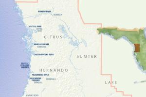
Some of the cities and towns located in the Springs Coast Watershed include Brooksville, Crystal River, Dunnellon, Homosassa, New Port Richey and Spring Hill. The trademarks of this watershed are the many springs that discharge to form rivers, the extensive coastal swamps and salt marshes, high pine woodlands and lakes.There are more than 200 documented springs that occur throughout the Southwest Florida Water Management District (District). Five of these have a discharge of…
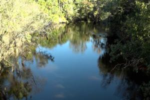
In addition to flow from springs, the Withlacoochee River also receives water from several tributaries. The most notable are the Little Withlacoochee River, Gum Slough, Jumper Creek and the Outlet River from Lake Panasoffkee.Several lakes, including Lake Panasoffkee, Tsala Apopka and Lake Rousseau, are also key features that affect river flows. Along with the Withlacoochee and Rainbow rivers, these lakes are all designated Outstanding Florida Waters by the State of Florida.…
Updated February 2026Our mission is to protect water resources, minimize flood risks, and ensure the public’s water needs are met.The Strategic Plan provides a road map for how the District will meet the water resources challenges of west-central Florida by identifying what needs to be accomplished, how the job will be done, and how success will be measured. In addition to identifying the District’s programs, the Plan targets specific priorities in each of the our four…
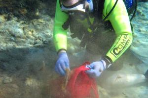
The Chassahowitzka Springs Restoration Project improved water quality and the bottom habitat for plants and animals. Project OverviewThe Southwest Florida Water Management District restored portions of Chassahowitzka Springs by removing accumulated sediments, which improved the water quality and the bottom habitat for plants and animals.BackgroundSand and organic materials have been transported by flows from residential canals and stormwater runoff to the springs and…
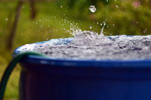
A How-to for Installing a Rain BarrelBenefits
- Supplement irrigation and save money over time
- Reduce stormwater runoff which can lead to reduced levels of pesticides and fertilizers in our water
- Help reduce the amount of water that may settle around the foundation of your home
- Connect to a soaker hose (with the pressure-reducing washer removed)
- Fill a watering can and hand-water plants, flower beds…