Search Content
Displaying results 201 - 220 of 2166
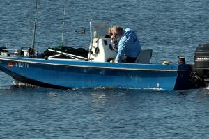
May 2026Q: What is a water control structure?A: The primary purpose of the District’s water control structures is to manage the flow of water in lakes and river systems. Water control structures vary greatly in size and complexity. The District’s water control structures can be broadly classified into three categories: flood control, water conservation, and salinity barriers. Collectively, these structures allow the…
Four Marion County teachers are among the record number of educators who applied for and received Splash! mini-grants through the Southwest Florida Water Management District.This year the District awarded Splash! mini-grants to 209 educators totaling more than $413,000. That’s 72 more grant recipients than last year.Mary Margaret Hull, lead communications coordinator, attributes the increase in awardees to an increase in promotion among the District’s school…
As Hurricane Elsa approaches, the District’s Emergency Operations Center (EOC) is monitoring the storm. It is important for staff to stay informed as the storm could potentially impact our region next week.
We will make every effort to communicate information to employees in the following ways:
- Internal Communications Emails: Employees should monitor their emails for updates.
- Emergency Telephone Hotline:…
The Atlantic basin hurricane season occurs June 1st through November 30th. During this time, there is a heightened risk of severe rain events, high winds, flooding and storm damage.
Many employees have designated roles, performing various functions, within the Emergency Operations Organization (EOO) during emergency incidents. All employees may be called upon to support those functions during any particular event. The EOO chart (page 3) identifies the roles of…
Basin Board Members Tour River
District staff and Governing Board and Basin Board members tour the Withlacoochee River.
Members of the District’s Withlacoochee River Basin Board recently toured the lower Withlacoochee River from Inglis to the mouth of the river.
The lower Withlacoochee River has undergone significant alteration with the construction of the Inglis Dam and the Western Terminus of the Cross Florida Barge Canal. The basin board provided…

Environmental Specialist Jeff Sowards has spent the past 15 years working to protect the Rainbow Spring System. That why he was recognized Tuesday by the District’s Governing Board as a 2017 Springs Community Partner.
Sowards has served as Rainbow Springs Aquatic Preserve Manager since 2003, where he oversees ecosystem science, resource management, education and outreach. He conducts his work in partnership with government and private entities to benefit the unique…
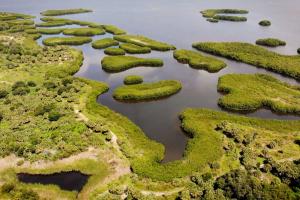
A watershed is an area of land that water flows across as it moves toward a common body of water, such as a stream, river, lake or coast. The Alafia River watershed is approximately 270,000 acres, or 418 square miles. Although a portion of the watershed lies in Polk County, most of it lies in Hillsborough County. In fact, it’s the largest watershed in Hillsborough County.
.embed-container {position: relative; padding-bottom: 70%; height: 0; width: 150%;margin-left:-…
As Tropical Depression Fred approaches Florida, the District’s Emergency Operations Center (EOC) is monitoring the storm and is expected to activate tomorrow. It is important for staff to stay informed as the storm could potentially impact our region this weekend.
We will make every effort to communicate information to employees in the following ways:
- Internal Communications Emails: Employees should monitor their emails for…
The Hydrologic Conditions Report provides an excellent historical record for long-term local and regional hydrologic analysis.
The Hydrologic Conditions Report is generated monthly and provides an analytical summary of regional and temporal variations in the hydrologic conditions for planning and regulatory purposes. In addition, it provides an excellent historical record for long-term local and regional hydrologic analysis.
Data collected are used by the regulatory,…
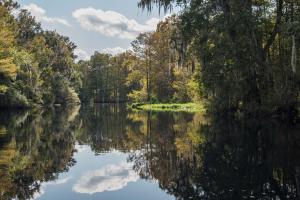
A watershed is an area of land that water flows across as it moves toward a common body of water, such as a stream, river, lake or coast. Watersheds are defined by the way water flows across the land and are shaped by features and elevations on the surface of the land.The Withlacoochee River watershed covers approximately 2,100 square miles within eight counties — Citrus, Hernando, Lake, Levy, Marion, Pasco, Polk and Sumter.…
In recent years the number of people living in the Alafia River watershed has increased dramatically. An increase in population causes a greater demand on water resources and a reduction in the amount of wildlife habitat. Efforts have been made to meet the increased demands for water and to restore and protect natural ecosystems within the watershed.
Reservoir
The C.W. “Bill” Young Regional Reservoir is located in the Alafia River watershed. It can store 15 billion…
The Green Swamp Wilderness Preserve is cherished for its exquisite scenic beauty and is an ideal place to experience natural Florida. Be sure to check out the District’s Recreation website to learn more and plan your visit to the Green Swamp. Footpaths and trails abound in the Preserve for extensive hiking and the Florida National Scenic Trail bisects the area. Trails for…
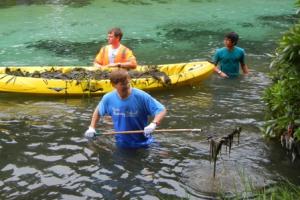
This project improved water quality in the Weeki Wachee River.Project OverviewThe Southwest Florida Water Management District and Hernando County made enhancements to stormwater management at Rogers Park. The park is owned by the County and located on the Weeki Wachee River. These improvements benefit the river by reducing the amount of sediments and nutrients entering the river. Project DetailsThis project uses Low Impact Development (LID) techniques to…
The Florida Department of Environmental Protection (DEP) approved adding three first-magnitude spring systems — Weeki Wachee River, Chassahowitzka River and Homosassa River — to the Surface Water Improvement and Management (SWIM) Program priority list.
The existing SWIM Program priority list includes two first-magnitude spring systems – Rainbow River and Crystal River/Kings Bay. The DEP approval brings all five of the District’s first-magnitude spring systems onto…
The District’s Governing Board recently voted to begin the process of adding three first-magnitude spring systems — Weeki Wachee River, Chassahowitzka River and Homosassa River — to the Surface Water Improvement Management (SWIM) Program priority list.
The existing SWIM Program priority list includes two first-magnitude spring systems – Rainbow River and Crystal River/Kings Bay. Today’s action initiates bringing all five onto the SWIM Program priority list.…
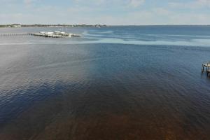
Fresh water from the Peace River watershed is essential to the health of the Charlotte Harbor, the second largest estuary in Florida. The watersheds of the Myakka and Caloosahatchee rivers also feed into the harbor.
An estuary is a partially enclosed body of water where fresh water from rivers and streams flows into the ocean. The Charlotte Harbor estuary is 30 miles long by seven miles wide and boasts 219 miles of shoreline.…
June 2024Q: What does the District do to prepare for hurricane season?A: Year-round, the District operates 84 water control structures in its 16-county area. These structures assist with flood protection, manage lake water levels and prevent saltwater from flowing up freshwater streams and creeks. To prepare for hurricane season, staff conduct annual hurricane readiness checks of all the District’s structures to ensure they are…
The "Southwest Florida Water Management District (District) Governing Board ":http://www.swfwmd.state.fl.us/about/governingboard/ voted today to begin the process of adding three first-magnitude spring systems -- Weeki Wachee River, Chassahowitzka River and Homosassa River -- to the Surface Water Improvement Management (SWIM) Program priority list. The existing SWIM Program priority list includes two first magnitude spring systems – Rainbow River and Crystal River/Kings Bay…
Marion County students at two schools will study the issues surrounding our freshwater resources thanks to "Splash! school grants":http://www.swfwmd.state.fl.us/education/schoolgrants/ from the Southwest Florida Water Management District.The Marion County awardees are:* Thomas Allison, *Dunnellon Middle*, was awarded $2,390. Students will visit the Withlacoochee and Rainbow rivers to test water quality. Students will learn how human actions affect the flora and fauna on the…