Search Content
Displaying results 1861 - 1880 of 4998
Your Questions AnsweredNovember 2021Florida has the largest concentration of springs in the world, with more than 200 springs within the boundaries of the Southwest Florida Water Management District. These natural wonders rely on rainfall to replenish their water source, and Dr. Madison Trowbridge explains how the rainy season provides big benefits for Florida’s springs.Q: What is spring flow?A: Spring flow is the amount of water that…
Seek the Leak
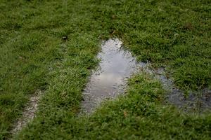
Did you know that even a small leak can waste 300 or more gallons of water per month? Check for the following leaks outdoors:
Water Faucets, Hoses and Connectors
Check all faucets, hoses and connectors periodically for leaks and to make sure they are in good working order. Make sure faucets are closed when not in use. If you do find a leaky faucet, change the washer — after turning off the shutoff valve.
Automatic Lawn and Sprinkling Systems
Soft…
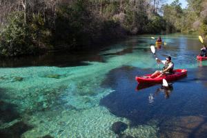
The District uses a variety of tools to protect our springs but it takes a community effort by all of us. There is no single solution to protecting Florida springs. The District uses a variety of tools to help protect them. But it takes the work of all of us to protect these resources. There are various ways you can help when visiting a spring and even at home. How to responsibly enjoy a spring:
- Stay in the vessel when possible.
- If you have to…
Addressing Drainage Complaints and IssuesAre you experiencing flooding or drainage not caused by a storm event? Confused about which government agency to reach out to for help? Use this reference guide to find out who to contact. Contact the Southwest Florida Water Management District for drainage complaints or issues related to:
- Stormwater management systems (i.e. retention ponds, swales, etc.) in District-…
Regular irrigation maintenance is important to reduce water waste and help create a healthy environment for your landscape. Look for Broken or Misdirected Sprinkler Heads Sprinkler heads can accidently be knocked during lawn maintenance or from a passerby. Look for these signs of a broken or misdirected sprinkler head.
- Water is shooting into the air or not spraying correctly.
- Water is pooling around the base of a sprinkler head.
- …
As chief of the Natural Systems and Restoration Bureau, Randy Smith oversees several District water quality and natural systems initiatives and programs within the Resource Management Division. His key responsibilities include providing leadership to the Environmental Flows and Levels Section, the Surface Water Improvement and Management (SWIM) Program, and the Resource Management Division Business Support Section.Smith has worked at the District for more than 19 years. He…
As the District’s General Counsel, Chris Tumminia provides advice and counsel to the District’s Governing Board, executive director and District staff regarding matters of law and policy. His primary areas of practice have included civil and administrative litigation, water use permitting, minimum flows and levels, and water supply planning. Tumminia also has represented the District in numerous proceedings before the State of Florida Division of Administrative Hearings,…
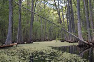
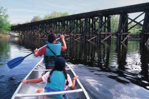
Our journey along the Withlacoochee River begins in the cypress domes and forested wetlands of the Green Swamp. Four rivers emerge from this large oasis between Tampa and Orlando. It is an area of ecological and hydrologic importance because of its ability to store surface water and slow floodwaters while sustaining flow to multiple rivers and streams. The Green Swamp also supplies water to the aquifer, which isn’t too far below the land’s surface in…
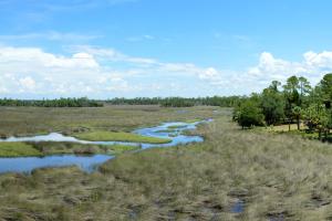
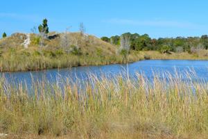
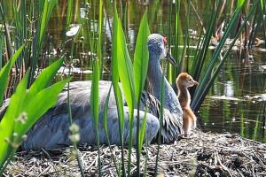
The Weekiwachee Preserve is an area of protected land owned by the Southwest Florida Water Management District (District). Covering over 11,200 acres, the preserve is in Hernando County. It provides a wide array of wildlife habitats, including several miles along the Weeki Wachee River, portions of the Mud River, dense hardwood swamps, freshwater and saltwater marshes and pine-…
Your Questions Answered
April 2020
You may have noticed, we haven’t seen much rainfall around the District. Southwest Florida Water Management District Hydrologic Data Manager Granville Kinsman is our resident expert on hydrologic conditions and has details about our current rainfall pattern.
Q: What is the normal rainfall cycle in central Florida?
A: Rainfall is seasonal. Our rainy season is a four-month…
Every year about 2.5 million people visit public conservation lands obtained by the Southwest Florida Water Management District and its partners to protect Florida’s water resources.Balancing water needs.Protecting the environment. The District was created in 1961 by the Florida Legislature to protect the water resources of the region. The District includes roughly 10,000 square miles in all or part of 16 counties in west-central Florida that were home to a population…
Conservation LandsThe region’s lands and waters are forever linked by Florida’s natural water cycles. Undeveloped land allows for water recharge to the aquifer and water storage during major storm events. Lands surrounding lakes, rivers, wetlands and estuaries also serve as natural buffers to filter out pollution before it reaches the nearest water body. The Southwest Florida Water Management District and other agencies and governments purchase conservation lands to preserve…
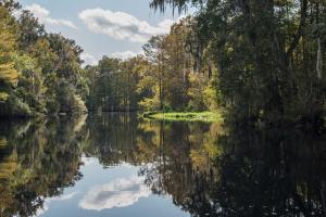
A watershed is an area of land that water flows across as it moves toward a common body of water, such as a stream, river, lake or coast. Watersheds are defined by the way water flows across the land and are shaped by features and elevations on the surface of the land.The Withlacoochee River watershed covers approximately 2,100 square miles within eight counties — Citrus, Hernando, Lake, Levy, Marion, Pasco, Polk and Sumter.…
Your Questions Answered
February 2019
Q: Is there a rainy season and dry season in central Florida?
A: Yes, rainfall is seasonal. Our rainy season is a four-month period from June through September, with average rainfall of about 7.8 inches each month. About 60 percent of our average annual rainfall is received during that time. The higher rainfall results in rising water levels in wells, lakes, rivers and springs…

One of the best places to take on actions that help protect water quality and conserve water resources is in your own yard. If you’re not allowed to or don’t have a yard, check in with your teachers to see if you and your friends can make positive changes right at school! Small changes outdoors can make a big difference in protecting Florida’s environment and keeping your local watershed healthy.
The number of people moving to Florida is growing every…
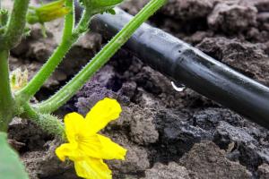
Micro-irrigation, commonly referred to as “drip” or “low-volume” irrigation, emits a lower volume of water compared to traditional sprinkler heads. Micro-irrigation delivers water directly to plant roots and is recommended for plant bed areas or potted plants, as they require less water than turfgrass.Types of micro-irrigation include:BubblersIn-Line Drip TubingMicro-SpraysPoint Source Emitters …
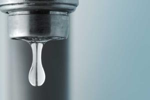
Faucets »
Check for leaks
Water losses caused by dripping faucets can range from several gallons to hundreds of gallons of water per day. Check faucets regularly for leaks at the faucet head and seepage at the base and its connections.
Fix leaks
Whether a two-handled or a single-handled faucet, leaks are repaired by replacing washers and by tightening or repacking the faucet stem. Do-it-yourselfers can find a variety of repair kits in local home improvement and hardware…

Showers »
Check for Leaks
Dripping showerheads can waste from 70 up to several hundred gallons of water a week, depending on the size of the drip. If the showerhead is leaking, make sure it is screwed tightly. Also, remember to check the washer for wear. If you need a new washer, you can get one at your local hardware store or from your plumber.
Fix Leaks
To fix a leaky showerhead, you need an adjustable wrench or pliers and joint sealer or tape. Follow these steps:…
It is the intent of the District Governing Board that environmental criteria be implemented in a manner that achieves a goal of no net loss of wetlands or other surface water functions (unless otherwise exempted by statute or rule).
(Condensed and modified from Environmental Resource Permit Information Manual, Part B – Basis of Review, Chapter Three – Environmental)
Wetlands serve as spawning, nursery and feeding habitats for many species of fish and…
The Southwest Florida Water Management District (District) does not have fertilizer restrictions, but many counties and municipalities do. Check with your local government to learn if there are mandatory fertilizer restrictions or few the list below. A fertilizer blackout is a time when using fertilizers containing nitrogen and phosphorus are prohibited, usually during the rainy season. Heavy rain can wash fertilizers, especially granular ones, from lawns to streets,…