Search Content
Displaying results 2801 - 2820 of 5101
The drowning of thousands of chickens at several Masaryktown chicken farms was one of the catalysts for the creation of the District.
From devastating flooding caused by hurricanes to severe droughts to an unprecedented freeze, major weather events have played an important role in shaping the District’s policies and procedures during the last 50 years…

The Southwest Florida Water Management District includes Florida’s notorious “Lightning Belt.” It is famous because of the number of thunderstorms and lightning strikes that occur here. They don’t call the hockey team the “Tampa Bay Lightning” for nothing. Florida’s lightning strikes are thought to be especially powerful, thanks to the huge, highly charged clouds that form here.
How powerful are they? Hot bolts have temperatures above 14,000°C. If they hit a tree, it…
Left: This overhead view shows the wind generator, solar panel and control box of the structure controls at the Medard Dam.
Right: The structure staff operates and maintains the District’s structures, including the structure at the Medard Dam. Back row left to right: Sal Destefano, structure controls senior tradesworker; Dan Pelland structure controls senior tradesworker; Garry Flood, structure controls tradesworker; Robert Sowders, structure Maintenance tradesworker;…
Left: Addison Bennett, granddaughter of District Executive Director Dave Moore, tries to stay dry at the Hampton Tract. Top right: Karen Fraley, Around the Bend Nature Tours, shows Brady Whalen from Boy Scout Troop 311 how to use a pump drill to start a fire. Above right: Emma Mason, Around the Bend Nature Tours, takes a visitor on a guided hike.
More than 130 people braved the rain Feb. 27 at the District’s “Get Outside!” event at the …

NOTICE: Effective July 1, 2014, a person may not lobby a water management district in Florida until such person has registered as a lobbyist with that district by filing a registration form.Pursuant to Section 112.3261, Florida Statutes, starting July 1, 2014, a person may not lobby a…
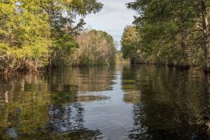
This project helped develop techniques to control algae and restore aquatic plants in the lower portion of the Rainbow River.BackgroundIn the lower portions of the Rainbow River, native aquatic vegetation may be decreasing while various types of algae, such as filamentous macroalgae (Lyngbya) and phytoplankton, may be increasing. An increase in algae downstream is typical in most rivers as the river’s velocity — the speed at which water flows — decreases and water…
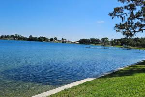
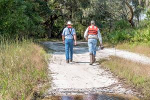
As the weather gets cooler, now is the time for Floridians to get outside and enjoy a variety of recreational activities. Each issue of WaterMatters features a different District property ready for you to explore. These public lands are close to home and are free or very inexpensive to use.
This issue features the Lower Hillsborough Wilderness Preserve (Preserve) in Hillsborough County.
The 16,000-acre Preserve…
Left: Bruce Wirth, a District deputy executive director; Sallie Parks, Governing Board member and co-chair ex offico of the Pinellas-Anclote River Basin Board; and Cheryl Johnson, secretary of the Alafia River Basin Board, helped plant a tree to celebrate the completion of the restoration project. Center: Dozens of volunteers planted marsh grass to help complete the restoration project. Right: Many volunteers brought their children to help at the volunteer planting.…
The Florida Department of Environmental Protection has published the Florida Statewide Annual Report on Total Maximum Daily Loads, Basin Management Action Plans, Minimum Flows or Minimum Water Levels, and Recovery or Prevention Strategies on its website pursuant to section 403.0675, F.S. This report includes the status of protection and restoration actions through total maximum daily loads, basin management action plans, minimum flows or minimum water levels, and recovery or…
More than 500 volunteers who spend thousands of hours a year helping the Southwest Florida Water Management District maintain and improve public lands, as well as restore Tampa Bay, were honored this weekend during the District’s Annual Volunteer Appreciation Day.The celebration was held at the District’s Lake Panasoffkee property and featured an awards presentation, exhibits, live music, a picnic lunch and a nature hike.Approximately 450 volunteers are involved with the…
As Data Collection bureau chief, Sandie Will is responsible for overseeing the Geohydrologic Data; Hydrologic Data; the Water Quality Monitoring Program; and Mapping/GIS sections. Activities conducted in these sections include coring; well construction; aquifer performance testing; water level and atmospheric data collection; groundwater and surface water quality sampling; land surveying; laboratory analyses; geospatial data…
OverviewApplicants will be asked to break this down in more detail in the application. Students will learn about local freshwater ecosystems in west-central Florida, with a focus on our magnificent springs. After an introductory lesson on habitats and ecosystems, students will dive deeper to learn about springs, the wildlife they support and their connection to the aquifer below. As part of their exploration, students will complete the…
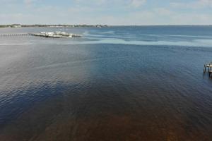
Fresh water from the Peace River watershed is essential to the health of the Charlotte Harbor, the second largest estuary in Florida. The watersheds of the Myakka and Caloosahatchee rivers also feed into the harbor.
An estuary is a partially enclosed body of water where fresh water from rivers and streams flows into the ocean. The Charlotte Harbor estuary is 30 miles long by seven miles wide and boasts 219 miles of shoreline.…
Minimizing flood risks is an important part of the mission of the Southwest Florida Water Management District (District). The District and local governments work together to minimize flooding impacts, protect personal property and assist flood victims during and after storm events. Flooding from a storm or natural disaster If you are experiencing flooding, your first contact should be your local government.…
This project restored shoreline habitat to improve water quality in Kings Bay.
Project Overview
The District restored the shoreline around Hunter Springs Park. The City of Crystal River has integrated this District project into the redesign of the park.
The restored shoreline will benefit the Crystal River/Kings Bay spring system by creating habitat and improving water quality through reducing erosion and nutrients entering Kings Bay.
Background…
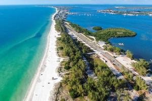
A bay is a shallow body of salt water between a larger barrier island and the mainland. A barrier island is a long, narrow sandy island parallel to the shore. Palma Sola Bay is located between the barrier island of Anna Maria and the city of Bradenton.In the 1880s, a fishing village called “Cortez” was formed here and was bustling with fishermen. It's one of the last commercial fishing villages in Florida and is on the National Register of Historic Places. Tarpon,…
Overview The Southwest Florida Water Management District is currently developing new minimum flow standards for the Upper Peace River. Minimum flows are limits established by the District’s governing board for surface water courses and are intended to prevent significant harm to the water resources or ecology of an area that may be caused by water withdrawals. The Upper Peace River, which is the northernmost section of…
The District adopted new minimum levels for Lake Angelo and Lake Denton, located in northern Highlands County in 2025.MFL OverviewThe District is directed by the Florida Legislature to establish minimum flows and levels (MFL) for water bodies within its boundaries. Minimum levels are defined in…
Staff »
The District emphasizes scientific and technical excellence along with providing high quality service to the residents of our region. For the past 60 years, the District’s greatest asset has been our staff who have dedicated their professional careers to meeting the District’s mission of protecting water resources, minimizing flood risks, and ensuring the publics water needs are met. District functions are organized into divisions, but staff use extensive teamwork and…
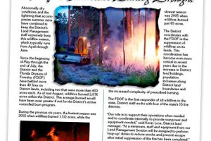
Abnormally dry conditions and the lightning that accompanies summer rains have combined to keep the District’s Land Management staff extremely busy this wildfire season, which typically runs from April through June.
Since the beginning of May through the end of July, the District and the Florida Division of Forestry (FDOF) have battled more than 40 fires on District lands, including two that were more than 400 acres each. As of mid-August, wildfires burned 2,076 acres…