Search Content
Displaying results 1901 - 1920 of 4998
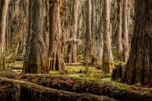
The beat of central Florida’s hydrologic heart lies between Tampa and Orlando in 560,000 acres of Florida backcountry called the Green Swamp. The Green Swamp includes portions of Polk, Lake, Sumter, Hernando and Pasco counties. Within these acres is a complex, integrated and delicate natural system composed of cypress swamps, hardwood forests, marshes, pine flatwoods and sandhills. Emerging from this precious oasis are the Hillsborough, Withlacoochee, Ocklawaha and…
About the Watershed Management ProgramThe District takes a watershed approach to managing water and water-related resources within its boundaries. By doing so, all the characteristics of each watershed can be evaluated to reflect the real, interconnected nature of Florida’s water resources. This increases the District’s ability to clearly identify, prioritize and address issues related to the area’s water resources. The Watershed Management Program provides a method to…
A watershed is an area of land that water flows across as it moves toward a common body of water, such as a stream, river, lake or coast. The Alafia River watershed is approximately 270,000 acres, or 418 square miles. Although a portion of the watershed lies in Polk County, most of it lies in Hillsborough County. In fact, it’s the largest watershed in Hillsborough County.
.embed-container {position: relative; padding-bottom: 70%; height: 0; width: 150%;margin-left:-…

Each year the District generates population projections for the 16 counties wholly or partially under its jurisdiction.InstructionsSection C-1GIS model population projections by county, utility and public supply service area Section C-2GIS model parcel-level population projectionsThese parcel-level projections, combined with any GIS boundary, can be used to develop population projections for any given area. (All files .zip).•…
The Governing Board has the statutory authority to issue emergency and non-emergency orders to apprise the public of the need to protect water supplies for: public health, safety and welfare; health of animals or aquatic life; a public water supply; or other reasonable uses.The executive director has the statutory authority to issue emergency orders when immediate action is necessary. Emergency orders are subsequently presented to the…
Fertilize Smart, Protect Our Waterways. #FertilizeSmartUnlock expert tips on fertilizing your lawn the right way—at the right time, with the right fertilizer—to keep your grass green and our water clean!Download Your Free Guide!Sign up for the Water 101 for Homeowners newsletter and get access to your free fertilizing guide instantly. Get Your Free Guide
function redirectToPDF() {
setTimeout(function() {
window.location.href…
This project will investigate the recharging of excess surface water, treated to primary drinking water standards, into the Upper Floridan aquifer more than 1,000 feet below the land’s surface. The recharged water has the potential to help improve groundwater levels and reduce the rate of saltwater intrusion from the Gulf of America in the SWUCA’s Most Impacted Area.SWUCA Recovery and Natural System ImprovementIn 2017, the District conducted a feasibility study at…
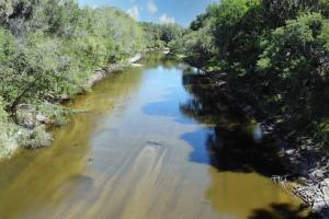
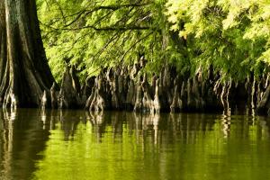
The Peace River gets its fresh water from rainfall. Annual rainfall averages approximately 53 inches, with more than half occurring between June and September. Most of the rainwater reenters the atmosphere through evaporation and plant transpiration. The rest recharges the aquifer or runs off into the Peace River and its tributary streams. The river is primarily a blackwater river. This type of river drains pine flatwoods and cypress swamps and has dark, stained waters…
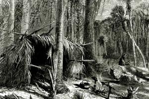
6000 B.C.While archaeologists report evidence of human activity in the Green Swamp dating back to as early as 6000 B.C., permanent ancient human settlements have never been discovered. However, it has always been home to an abundance of plant and animal life, making it attractive for human use. The land was used by ancient peoples for hunting and food gathering, as well as collecting material to make weapons.1513-1542 A.D. Hernando de Soto explored the area …
An Environmental Resource Permit (ERP) is required before beginning any construction activity that would affect wetlands, alter surface water flows, or contribute to water pollution.Environmental Resource PermitsAs authorized by Part IV of…
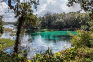
The Rainbow River in Marion County begins at Rainbow Springs in the town of Dunnellon and makes its way 5.7 miles until it merges with the Withlacoochee River. The Withlacoochee River ultimately discharges into the Gulf of America on the border of Citrus and Levy counties.Rainbow Springs has the fourth largest flow of all Florida’s springs and provides fresh water to the Rainbow and Withlacoochee rivers. The…
The purpose of the Environmental Advisory Committee (EAC) is to provide input into District programs and activities.This includes regulatory programs, rule revisions, water conservation activities, water resource planning, water resource and supply development projects, research and other water resource management projects that relate to the environment. Subject matter considered by the EAC shall relate to the statutory duties and responsibilities of the District.EAC members…
Canoeing »
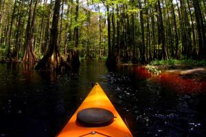
Explore the deepest wildlands of a Florida blackwater cypress swamp, or float down the crystal clear waters of a pristine spring-fed stream.
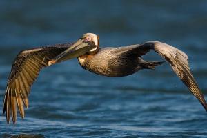
District lands preserve hundreds of miles of pristine shoreline along many of the beautiful rivers and lakes in the region. Whether it is a great blue heron stalking its prey, an alligator sunning on a log or a deer getting a drink from the cool, clear waters of a spring-fed river, there are endless opportunities to view wildlife in…
The Weeki Wachee Springs Restoration Project improved water quality and enhanced the overall natural system.
Project Overview
The Southwest Florida Water Management District restored portions of Weeki Wachee Springs in 2009 to improve water quality in the headspring and the upper river, as well as enhance the overall natural system.
Background
The Weeki Wachee Restoration Project was the second project aimed at cleaning up the springs.
The first project…
This project improved water quality in the Weeki Wachee River.Project OverviewThe Southwest Florida Water Management District and Hernando County made enhancements to stormwater management at Rogers Park. The park is owned by the County and located on the Weeki Wachee River. These improvements benefit the river by reducing the amount of sediments and nutrients entering the river. Project DetailsThis project uses Low Impact Development (LID) techniques to…

Moving southwest you will find Crystal River, which is in Citrus County and runs from the town of Crystal River west for seven miles towards the Gulf of America. Crystal River’s headwaters is an area known as Kings Bay, which has more than 70 springs. Crystal River/Kings Bay is the second largest springs group in Florida, the first being Wakulla Springs in northern Florida near Tallahassee.Many of the river's springs are 20 to 30 feet deep, and the water discharging from…
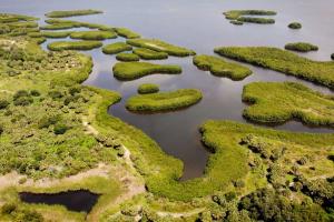
Residents and tourists have flocked to the Sarasota Bay region for years due to its remarkable natural beauty. Sarasota Bay is a subtropical estuary with a surface area of approximately 52 square miles. An estuary is a semi-enclosed body of water where fresh water mixes with salt water.The area features outstanding fishing, boating and wildlife viewing. It’s home to a wide variety of marine life, including manatees, mullet, dolphins, spotted sea trout, snook, red drum (…
River Model Scenarios
Nineteen scenarios have been identified through years of meetings and workshops with external stakeholders, special interest groups and residents. These scenarios are being tested by the model to show how historical alterations have affected the river and watershed. They include:
- Five scenarios in the Green Swamp…

A watershed is an area of land that water flows across as it moves toward a common body of water, such as a stream, river, lake or coast.The majority of people in this watershed live within 10 miles from the Gulf of America. This means that many of the activities that take place in the watershed where people live — from maintaining attractive landscapes to creating new roads and buildings — directly impact the gulf and every water body leading up to it. The Southern…