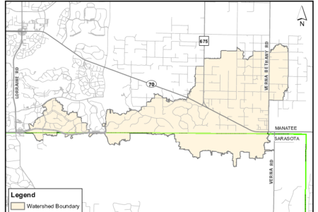
Manatee County and the Southwest Florida Water Management District (SWFWMD) are developing a watershed model and associated Watershed Management Plan for the Cow Pen Slough Watershed.
The consultant performing the study is currently collecting data to characterize the watershed. We welcome any photos, documents, or historical information regarding your property to assist with further analysis. The information will be used to prepare a computer model to simulate how the watershed responds to large rainfall events.
Once approved, the model results will be used by the City, County and the SWFWMD in their respective permitting programs. The model results may also be used to update FEMA Flood Insurance Rate Maps (FIRMs) to help communities manage floodplains and flood risk and provide information to assist homeowners in making decisions about protecting their property and planning for emergencies.
If you have information that you can share with us, or if you have any questions about the project, please fill out the comment card (link below). You can also contact the WMP Info Line at (352) 415-0974, or via email at WMP@WaterMatters.org. Thank you for your assistance.
When filling out the online comment card please indicate in the comment field(s) if you have any of the following:
- Photos of flooding on or near your property.
- Survey data indicating ground elevations of your property.
- Elevation certificate for your home.
- Soils data indicating the types of soils located on your property.
- Information on how water flows through your property.
- Any other useful information that may assist with the accuracy of the study.
You may be contacted by District staff or the consulting firm on how we can obtain this information. If access to your property is required to collect data, we will contact you in advance. We appreciate your cooperation on this project.
Maps
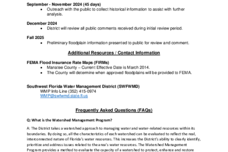
The watershed map (provided below) shows the Cow Pen Slough watershed limits. Please refer to the Read Me document (provided below) for more information about the watershed study and the projected timeline, contact information and a list of Frequently Asked Questions (FAQs).


