Southwest Florida Water Management District (District) is one of five regional agencies directed by state law to protect and preserve water resources within its boundaries. Established in 1961 to operate and maintain several large flood protection projects, the District’s responsibilities have expanded to include managing water supply and protecting water quality and the natural systems — rivers, lakes, wetlands and associated uplands.
Origin and Evolution
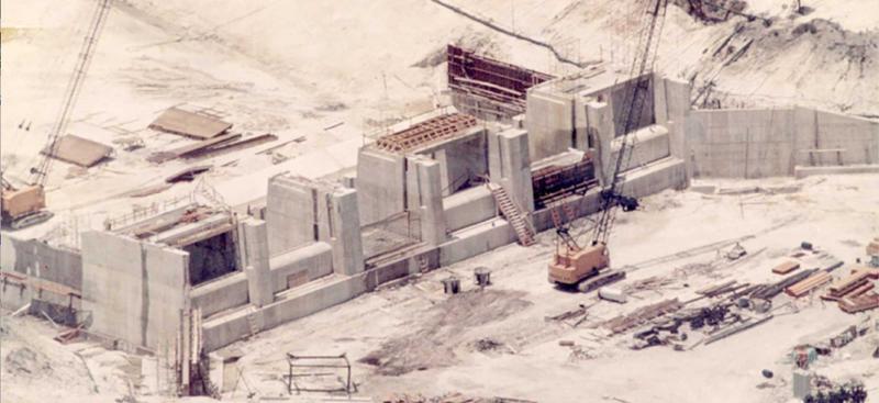
The Southwest Florida Water Management District (District) was created in 1961 by a special act of the Florida Legislature to be the local sponsor of the “Four River Basins, Florida Project.” This was a major flood control project sponsored by the U.S. Army Corps of Engineers (Corps) after Hurricane Donna caused massive damage to southwest Florida in 1960. The project included flood control structures and water detention areas, and encompassed a 6,000-square-mile area. We continue to cooperate with the Corps today in maintaining and operating portions of this flood control system.
Our responsibilities expanded in the mid- to late-1960s when regulatory programs for regional wellfields serving the Tampa Bay metropolitan area were initiated, and again in 1972 when the Florida Legislature passed the Water Resources Act. The Act significantly furthered the transition from strictly flood control to a more broad-based policy of resource management and service to the public. The Act was in response to a growing need for a more comprehensive approach to water management in the State, and received recognition as a model water statute from the National Water Commission for its regional approach and comprehensive scope.
The District’s duties and responsibilities have increased over the years. Some of these new duties were the result of legislative action; others came about through delegation by state agencies; while others were initiated by the District under existing authority in response to evolving water management challenges. While our mission has remained essentially the same since passage of the Water Resources Act — to manage and protect water and related natural resources — the areas of responsibility now encompass water supply, flood protection, water quality management and natural systems management. Moreover, there is growing recognition that the integration of all these areas is essential to effective planning and management of the resource.
Evolution of Responsibilities
1960s
- Structural flood control (Four River Basins, Florida Project)
- Works of the District permitting
- Wellfield regulation
1970s
- Movement toward non-structural flood control
- Well construction permitting
- Consumptive water use permitting
- Minimum flows and levels
- Aerial mapping and floodplain delineation
- Management and storage of surface waters (MSSW) permitting
- Quality of Water Improvement Program (QWIP)
1980s
- Save Our Rivers program (land acquisition)
- Groundwater inventories
- MSSW major rule revisions
- Wetlands protection
- Water quality
- Wetlands protection (Warren Henderson Act)
- Ambient Groundwater Quality Monitoring Program
- Surface Water Improvement and Management (SWIM) Program
- Local government planning assistance program
- Well construction permitting in areas of groundwater contamination
- Water conservation/water shortage planning
- Cooperative Funding Initiative
1990s
- Water Resource Assessment Projects (WRAPs)
- Water Use Caution Areas (WUCAs)
- Environmental resource permit (ERP)
- Year-round conservation measures
- Xeriscaping incentive rule
- Ambient surface water quality monitoring
- Preservation 2000/Florida Forever (land acquisition)
- District water management plans
- Regional water supply planning
- Budget reporting/performance measurement
2000s
- Facilitating Agricultural Resource Management Systems (FARMS)
- Land and water linkage
- Support local government 10-year water supply facility plans
- Springs protection
- Strategic Plan
- Cooperating technical partner with FEMA for flood mapping
- Southern Water Use Caution Area (SWUCA) recovery strategy
- West-Central Florida Water Restoration Action Plan
- Water Management Information System (WMIS)
- Lower Hillsborough River Recovery Strategy
- Upper Peace River Recovery Projects
- Northern Tampa Bay Recovery Strategy
2010s
- Dover/Plant City Water Use Caution Area
- Springs Coast Steering Committee
- Central Florida Water Initiative and the Polk Regional Water Cooperative
- Business Plan
- Lower Floridan Aquifer Exploration as an alternative water supply
- Direct/Indirect Potable Reuse Projects
Area
The District encompasses all or part of sixteen counties on the west-central coast of Florida, from Charlotte County in the south to Levy County in the north. It also extends from the Gulf of America east to Polk and Highlands counties. The District contains 97 local governments spread over approximately 10,000 square miles, with a total population in 2021 of more than 5.5 million (BEBR, 2022). A map of the District shows District and county boundaries, planning regions and major watersheds maps.