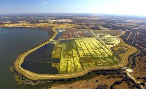
The Heartland Planning Region covers approximately 2,569 square miles and includes Hardee County and those portions of Highlands and Polk counties within the Southwest Florida Water Management District. Land uses in the region are diverse and include highly urbanized areas along the I-4 corridor in Polk County, extensive citrus groves along the Lake Wales Ridge, diverse agricultural lands in Hardee County and a large area dominated by strip mining for phosphate in southwest Polk County and northwest Hardee County.
The region’s hydrology features one major river, the Peace, which flows from its headwaters near Lake Hancock southward through central Hardee County, draining the majority of the region’s lands. The Lake Wales Ridge is a linear topographic high, trending north-south along the eastern side of the region, and is a high recharge area for the Upper Floridan aquifer with numerous lakes. Many lakes also are found in central Polk County. The region is underlain by three aquifer systems: the surficial, intermediate and Floridan. The latter is the primary source of water in the region and in the entire District area.
The 2015–2035 increase in water demand in the Heartland Planning Region is projected to be met by: 1) a combination of unused groundwater quantities that have been permitted to utilities in Polk County, 2) the beneficial use of reclaimed water instead of groundwater, 3) non-agricultural water conservation measures, 4) reductions in agricultural and industrial/commercial, mining/dewatering and power generation groundwater use resulting from conservation measures and land-use transitions, and 5) a potential alternative water supply source, the Lower Floridan aquifer.
Since 2011, the District has been working collaboratively with regional water supply utilities, the St. Johns River and South Florida water management districts (WMDs), the Florida Department of Environmental Protection (FDEP) and the Florida Department of Agriculture and Consumer Services (FDACS) on the Central Florida Water Initiative (CFWI). The CFWI region covers five counties, including Polk County as well as Orange, Osceola, Seminole and southern Lake counties. This is an area where the WMDs have determined, through water supply planning efforts, that groundwater availability is limited. The CFWI mission is to help protect, develop, conserve and restore central Florida’s water resources by collaborating to develop a unified process to address central Florida’s current and long-term water supply needs. A Steering Committee oversees the CFWI process and includes six members from water utilities, FDEP, FDACS and a Governing Board member from each of the three WMDs. The Steering Committee has guided the development of the first-ever CFWI Regional Water Supply Plan (RWSP), which ensures the protection of water resources and related natural systems and identifies sustainable water supplies through 2035. CFWI efforts will be reflected in the District’s 2015 RWSP update for the Heartland Planning Region and will lead to adoption of new rules and management strategies. Additional information about the CFWI can be found at CFWIwater.com.
